Technichal Specifications
How to use this exercise?
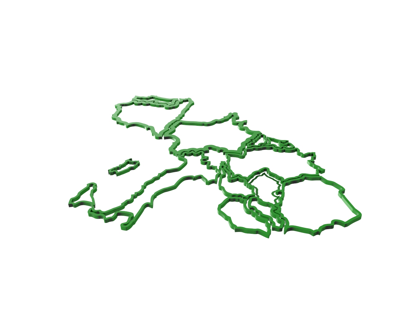
The model will be used to recognise EU countries by the shape of their borders and the and the geographical position taking into consideration the other countries.
Number of pieces of this exercise
12
General description
The model is composed of 12 independent pieces, each one representing a 3D printed rough model of the borders (only borders) of an EU country. All the pieces will fit together as a puzzle of central Europe.
In particular, here is the list of the countries:
1)Italy
2)Spain
3)France
4)Germany
5)Portugal
6)Austria
7)Hungary
8)Slovakia
9)Czech. Rep.
10)Poland
11)Belgium
12)Netherland
Only the borders should be 3D printed, with a thickness of 3 millimetres and height of about 5 mm, in order to have structures robust enough. The size scale (not the dimension) of all countries must be the same in order to fit all countries together as in a puzzle of central Europe.
The map was designed to be made in large dimensions. The support on which the pieces will be attached will be 500×700 mm large. The support can be made from a 3mm recycled wood panel. This will support the map and in turn will allow a good fixing to the wall
Additional Material
Models used:
License Info
Attribution 4.0 International (CC BY 4.0) https://creativecommons.org/licenses/by/4.0/You are free to:
Share — copy and redistribute the material in any medium or format
Adapt — remix, transform, and build upon the material
for any purpose, even commercially.
Under the following terms:
Attribution — You must give appropriate credit, provide a link to the license, and indicate if changes were made. You may do so in any reasonable manner, but not in any way that suggests the licensor endorses you or your use.
No additional restrictions — You may not apply legal terms or technological measures that legally restrict others from doing anything the license permits.
Learning Specifications
How can the model be used in class?
Each piece of model will be used by the teacher and the student to support the learner process of recognition of the related European countries, by identifying the border characteristics. All pieces can be jointly used to help the students to locate their geographical position in Europe. Rough estimates of the country surface will be possible, by a geometrical process of analysis and mathematical computation.
What benefits can its use have?
The benefits are mostly related to the opportunity of a hands-on exploration of the different parts of the model. The tactical sense, in addition to the optical one, will increase the memorisation of the country shape, the relative dimension with respect to the other countries and its location in Europe. The model will support the development of visual skills and geometrical calculation abilities of non-regular surface. Comparison between surface data and population numbers will also bring to population density estimates and to the discussion of historical and social issues. This model might support the development of a different view of the borders, not as a way to separate people, but as a way to characterise different regions, whose differences in language and culture represent a resource for the future of Europe.
Can it be used in other subjects?
Geometry, Mathematics, Social science, History (borders changes across time), Art and Technology.
